Home 7119

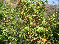 A few hollyleaf cherry bushes live along this part of Rooster Comb Trail
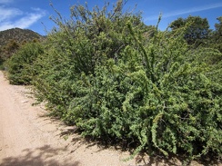 A few healthy barberry bushes grow along Pine Spring Road
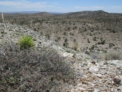 A few grey Range ratany bushes on the Trio Mine tailings pile still sport a few magenta flowers
 A few glints of hot yellow sunshine dart into Idora Mine Canyon as I hike back down
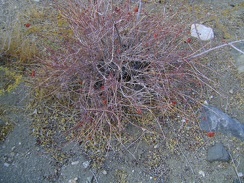 A few dried red buckwheat flowers from this past summer remain in Bull Canyon
 A few dips in the road create very brief downhills on the way up Beatty Cutoff
 A few Desert trumpets (Eriogonum inflatum) grow on this part of the Providence Mountains ridge overlooking Beecher Canyon
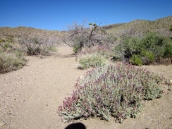 A few desert sages (Salvia dorrii) are still flowering here in Willow Wash
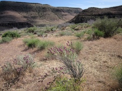 A few desert sages (Salvia dorrii) are still blooming here on the approach to Saddle Horse Canyon
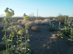 A few Desert milkweeds pick up the sun along old Route 66 as I get close to Essex, CA
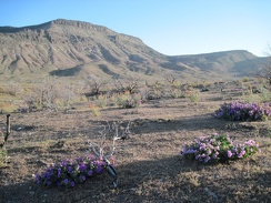 A few desert four o'clocks bloom near the junction of Wild Horse Canyon Road and the road to Blue Jay Mine
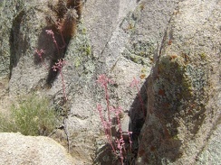 A few desert dudleya grow in the rocks along the old road
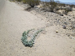 A few Coyote-melon vines extend out into the road along Nipton-Desert Road
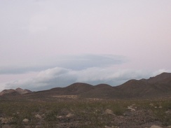 A few clouds are rolling in east of the Bristol Mountains at dusk
 A few Cliff roses bloom in the rocky drainage leading up out of Willow Wash
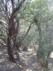 A few charming manzanitas further on down China Hole Trail.
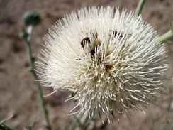 A few bugs enjoy this white thistle flower in Cedar Wash, Mojave National Preserve
 A few Brittlebrush flowers add a rare bit of colour to this hot-weather hike
 A few bright-pink dudleya stems brighten up the landscape as I follow the ridge down into Globe Canyon
 A few bouquets of yellow and orange dress up the seven-mile straight-line ride to Searchlight, visible even from here
 A few beavertail cactus blooms add a splash of colour to a slightly cloudy, olive afternoon
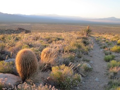 A few barrel cacti grow in the transition zone here between creosote-bush desert and the woodlands of the New York Mountains
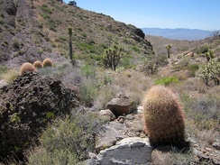 A few barrel cacti greet me as I arrive in the Bathtub Spring wash
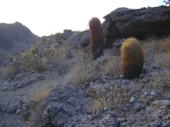 A few barrel cacti dot the hills near Cornfield Spring
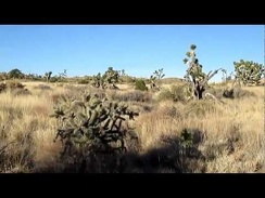 A family of small birds (probably Cactus wrens) flies away as I hike up the grown-in remains of an old desert road
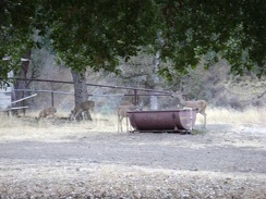 A family of deer visit Pacheco Camp to get a drink from the "horse spring."
 A fallen joshua tree lays in this wash below the Castle Peaks
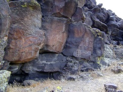 A faint hum oozes out of the lava, and it's not the spirit of the rock art whispering at me through the silence
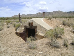 A dugout at Thomas Place, Mojave National Preserve
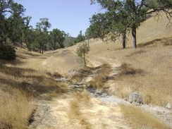 A dry creek crossing on Bear Spring Road.
 A drainage rut across Indian Springs Road
 A downed tree on Live Oak Spring Trail, Henry Coe State Park
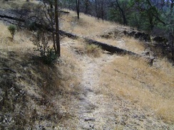 A downed pine tree lays across a switchback on the Rooster Comb Trail
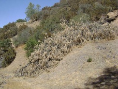 A downed pine tree blocks the first rise on the Canteen Trail.
 A discarded Bud Light beer can at roadside is a sign that I've re-entered "civilization"
 A different view of the Kelbaker Hills campsite showing the rocky hill behind it
 A different view across Death Valley from Aguereberry Point
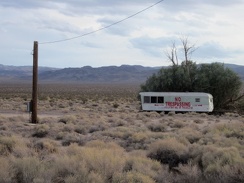 A different kind of no-trespassing sign: an entire trailer
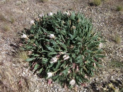 A desert primrose is blooming here along Highway 164
 A desert dudleya (perhaps Dudleya saxosa) pokes out from behind a rock on the way down the hillside
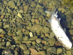 A dead fish rests in the large pool at China Hole
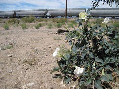 A datura blooms at Nipton campground while a long freight train squeals by
 A cow stands in the middle of Black Canyon Road, not sure what to make of me
 A cow is near my tent this morning; I shoo it away before leaving for the day on today's hike in the Cave Spring area
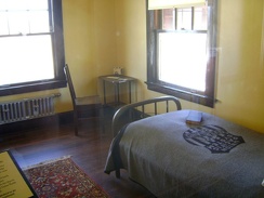 A couple of the small sleeping rooms are furnished in the simple style of the period
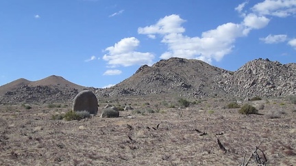 A couple of stray boulders sit on this part of Upper Black Diamond Spring Valley
 A couple of steep steps down here in Piute Canyon
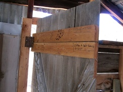 A couple of signatures adorn the inside of the door
 A couple of short steep hills on the final stretch on Wild Horse Canyon Road toward Mid Hills campground always get me
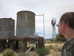 A couple of old water tanks and a windmill sit near Ivanpah Road at the OX Ranch site
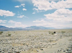 A couple of motorcycles speed by
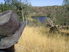 A couple of minutes later, and further south on Willow Ridge Road, I have a nice view down to Coit Lake
 A couple of miles down from my tent, a branch in the road to the left will take me to Sands
 A couple of little lumps on Globe Mine Road add interest to the ride down the fan
 A couple of hours after starting out, I finally reach the wash that I chose and beginning hiking up into the Bristol Mountains
 A couple of claret-cup cacti are blooming on this McCullough Mountains hillside
 A couple of cars pass me along Ivanpah Road
 A couple of bluejays perch on a burned tree, watching my tent
 A couple of big rigs pass me as we all descend Highway 127 into the Tecopa Basin together
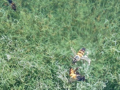 A couple of bees are swimming (or are they drowning?) in the spring tub at the end of Borrego Canyon Road
 A couple of aggressive yellowjacket wasps follow me as I slowly rise up this part of Borrego Canyon
 A couple more ceanothus bushes in the same area along Orestimba Creek Road, Henry Coe State Park
 A cool morning at Pachalka Spring, Mojave National Preserve, with Clark Mountain Range in the background
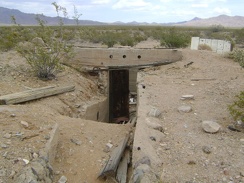 A concrete stairwell and heavy steel door lead into the basement
 A completely burned mound cactus at Eagle Rocks, Mojave National Preserve
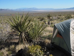 A colourful and very long freight train crosses the Ivanpah Valley a couple of miles down the fan from my tent
 A collapsed structure at the mine site at the end of the middle fork of Globe Mine Road
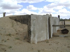 A closer view of the dugout reveals that its front wall is not concrete after all, but built of timbers covered in stucco
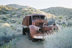 A closer view of Goldbelt Spring's truck
 A closer look shows that the lost balloon blew in from a Red Robin restaurant
 A closer look reveals that the front door has been pried open
 A closer look at the wallpaper, cardboard, and wallpaper interior at the Rex Mine boxcar cabin
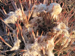 A close-up of the white fluff on the barrel cactus
 A close-up of the wash-out reveals buried posts that supported the old Barnwell and Searchlight Railway grade
 A close-to-full moon sits above the Woods Mountains just before sunset on this hot day
 A claret cup cactus grows in a boulder pile near Bathtub Spring, Mid Hills, Mojave National Preserve
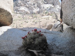 A Claret cup cactus blooms in a shady area of Eagle Rocks where I wouldn't expect to find one
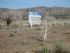 A chunk of land in Round Valley is for sale
 A cholla cactus watches me from a safe distance, Death Valley National Park
 A cattle-guard marks my entry into the McCullough Mountains area
 A cascade of sloping volcanic rock edges this wash in the Kelso Dunes Wilderness Area
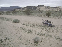 A carpet of low, ground-hugging plants casts an almost lush green tint over this area near Sands
 A car passes while I descend Kelbaker Road toward Kelso Depot
 A car passes me as I head up Highway 127
 A car passes me along this stretch of Wild Horse Canyon Road, the only one I'll see on the way back to camp
 A canyon just west of Wild Horse Mesa looks like a promising route downward
 A canteen hangs on the sign indicating Canteen Trail.
 A campfire ring by the trees adjacent to Pachalka Spring makes for an enticing place to set up camp
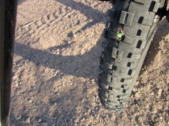 A cactus thorn punctures my tire and some Slime spurts out to fill the wound
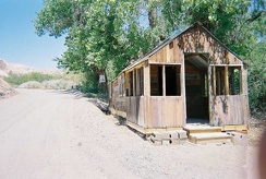 A cabin along China Ranch Road near the store
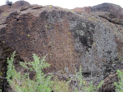 A bush of some kind manages to grow up on top of these rocks at the mouth of Saddle Horse Canyon
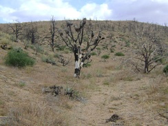 A burned joshua tree in the Mid Hills a couple hundred feet above the south side of Cedar Canyon Road
 A broken-down gate near Silver Lead Spring
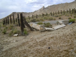 A broken-down brick cistern sits in the corral at Chicken Water Spring, Mojave National Preserve
 A brisk sunny morning on my camping mound with a view of Kelso Dunes
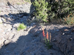 A brilliant penstemon manages to grow in the rocks here above Willow Wash; there's barely any soil here!
 A brilliant display of desert mallow flowers marks the end of Death Valley Mine Road; I'll turn right here on the old Cima Road
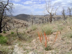 A bright-red firecracker penstemon is always a welcome sight in this often-beige landscape
 A bright blue streak in the rock at bottom right, presumably copper
 A bright and sunny morning overlooking Piute Gorge
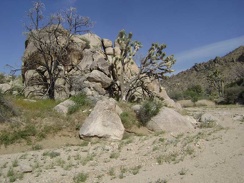 A boulder pile and joshua trees greet me as I arrive at Butcher Knife Canyon wash
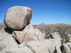 A boulder crowns other boulders at Eagle Rocks, Mojave National Preserve
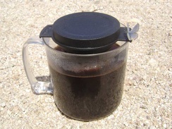 A bluish-grey moth with subtle peach trim visits my cup while coffee is steeping
 A blue delphinium adds a spike of colour in the joshua-tree forest
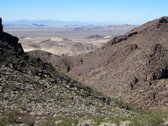 A bit past the rock outcrop, I continue up a ridge above a steep-sided drainage on the side of Sleeping Beauty
 A bit of rock, a bit of sand...
 A bit of drama on southbound Highway 127
 A bit of assorted debris is scattered around at the end of the Barnett Mine Road
 A bit lower down Pinto Mountain, under a canopy of burned trees, are a few flowers here and there
 A bit higher up, I'm treated to views out toward Orestimba Wilderness and Paradise Lake
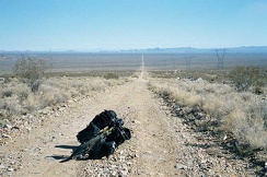 A bit higher up the road to Foshay Pass, I turn around to take in the view behind me
 A bit further, I turn back to look at Kelso Peak again
 A bit further up the Copper World Mine road, down in a gulley, is an old headframe
 A bit further up Orestimba Creek Road, I notice Will's Pond.
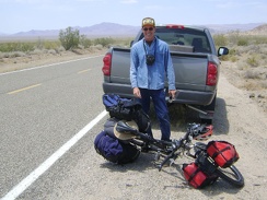 A bit further up Kelbaker Road: near mile 12, an oncoming pickup brakes and its driver shouts, "I love your web site!"
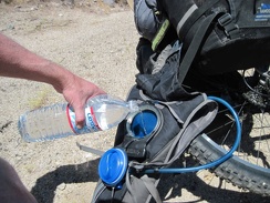 A bit further up Kelbaker Road, I stop again to refill my Camelbak, which has run dry again; any excuse for a break is good
 A bit further up Brant Road, I stop to look across the tortoise's habitat, and down toward Ivanpah Dry Lake
 A bit further north on Black Canyon Road, I reach my shortcut road over to Cedar Canyon Road and Pinto Mountain
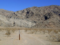 A bit further down Old Kelso Road I notice another Wilderness marker that people drive around and ignore
 A bit down the fan sits a fire ring next to which I was going to set up camp last night until I noticed goathead thorns all over
 A bit disappointed at having discovered only dryness at Macedonia Spring, I walk back down the drainage
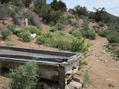 A bit beyond the Pine Spring corral is an old water trough and a rusty water tank
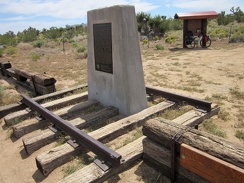 A bit beyond the OX Ranch site is a private, by-reservation-only campground called 'Mojave Desert Outpost'
 A bit above Hell's Gate, I turn back to see how much I've climbed since my rest stop there
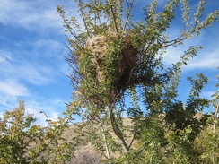 A bird's nest in a catclaw bush in Kelso Dunes Wilderness
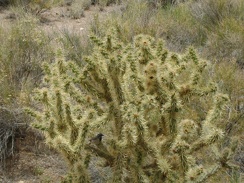 A bird flies past and lands in this cholla cactus
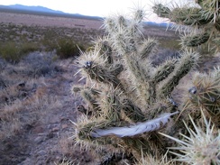 A bird feather is stuck in this cholla cactus
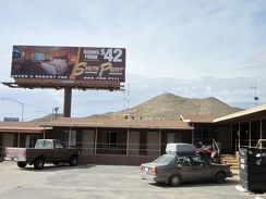 A billboard next to the Searchlight motel advertises a "luxury" motel elsewhere
 A big tree, partly broken, near the old Valley Wells town site
 A big sage is sprouting some fresh-looking growth
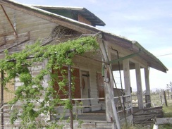 A big raven's nest sits in the eaves of the main house at Death Valley Mine
 A big patch of paperbag bush (Salazaria mexicana) in the wash leading into the Kelso Mountains
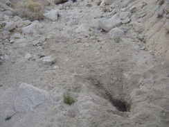 A big hole dug by an animal in a quest for water
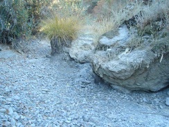 A big grass tuft (muhlenbergia, I think) sits in the dry creek bed.
 A better view of that switchback in the previous photo.
 A benign switchback on Willow Ridge Trail just beyond the log in the poison oak grove gives me a few more problems.
 A bee tightens up and launches itself toward a thistle bloom
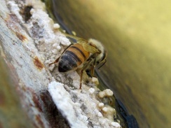 A bee sits on the edge of the Indian Spring cistern, enjoying the water's edge
 A beautiful sunset illuminates the Providence Mountains behind me as I climb Kelbaker Road out of Kelso Valley toward Baker
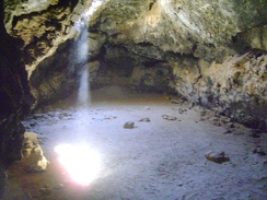 A beam of warm desert light shines down through the ceiling into the main room at the Lava Tube
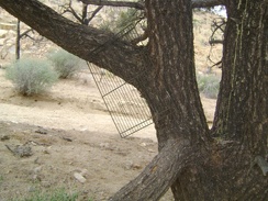 A BBQ grate hangs from that lone pinon pine in the wash
 A barren patch of earth catches my interest as I walk past
 A barrel-cactus garden at the mouth of "West Edgar Canyon #3," Providence Mountains
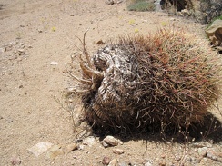 A barrel cactus has detached from its hillside garden and tumbled down into Juniper Spring wash
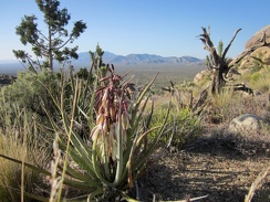 A Banana yucca sends out a fresh bouquet on the way up Teutonia Peak Trail
 A 24-hour donut shop on Barstow's Route 66 is closed due to the water contamination
 95 degrees in the shade at Pacheco Camp at 19h.
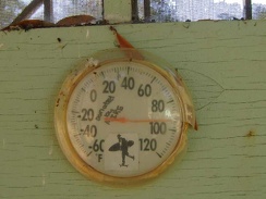 94 degrees down here in the shade where it feels "cool"
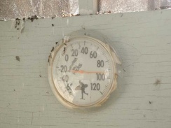 92 degrees in the shade, according to the thermometer on the side of the shower house.
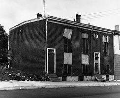 5559-61 Buddy Daye Street, Halifax, Nova Scotia, Fall 1982 (formerly Gerrish Street)
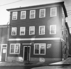 5534 Gerrish Street, Halifax, Nova Scotia, Fall 1982
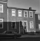 5531-5533 Buddy Daye St. (formerly 113-115 Gerrish St), Halifax, 1982
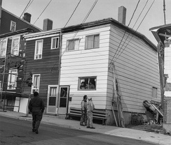 5527 Buddy Daye St, Halifax (formerly 5527 Gerrish Street)
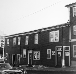 5524-32 Gerrish Street, Halifax, Nova Scotia, Fall 1982 (now Buddy Daye Street)
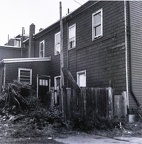 5524 Gerrish Street, Halifax, Nova Scotia (rear), Fall 1982 (now Buddy Daye Street)
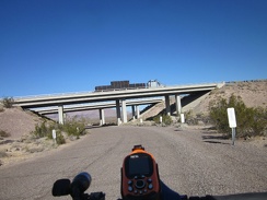 5 miles later, it's time to cross I-40 again, this time by crossing under it
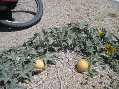 3865-coyote-melon
 35 minutes later: after 10 miles of gliding downhill (and pedaling too), I arrive at the stop sign and turn left on Ivanpah Road
 34 miles into today's ride, just before arriving at Fenner, I exit Mojave National Preserve for a while
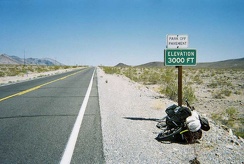 3000 feet, I'm almost at the top of my climb out of Death Valley
 3/4 mile from campsite 22, I exit Mid Hills campground and turn right to start descending Wild Horse Canyon Road
 3/4 mile down the road, I stop at the old Orestimba Corral for a Clif-bar-and-water break at the semi-shady picnic tables.
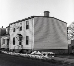 2577 Maynard Street (formerly 229 Maynard), Halifax, 1983
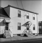 2577 Maynard Street (formerly 229 Maynard), Halifax, 1983
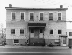 2565 Barrington Street, Halifax
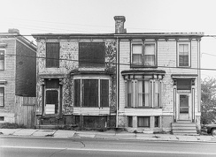 2521 and 2525 Barrington St, Halifax, 1982
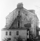 2507-11 Brunswick Street, Halifax, Nova Scotia, Fall 1982
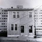 2447-49 Creighton Street, Halifax, Nova Scotia, Fall 1982
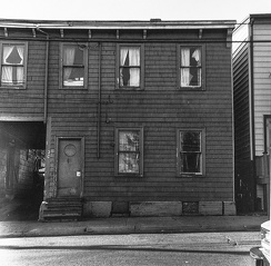 2406 Creighton Street, Halifax, Nova Scotia, Fall 1982
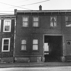 2404 Creighton Street, Halifax, Nova Scotia, Fall 1982
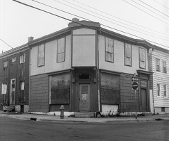 2390-92 Creighton Street, Halifax, Nova Scotia, Fall 1982
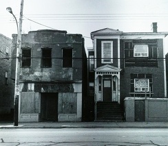 2387-80 Gottingen Street, Halifax, Nova Scotia, Fall 1982
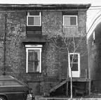 2376 Creighton Street, Halifax, Nova Scotia, Fall 1982
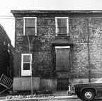 2370 Creighton Street, Halifax, Nova Scotia, Fall 1982
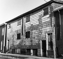 2369-73 Creighton Street, Halifax, Nova Scotia, Fall 1982
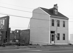 2195 Barrington Street, Halifax, Nova Scotia, 1982
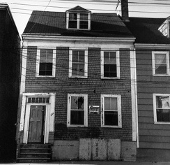 2120 Creighton Street, Halifax, Nova Scotia, Fall 1982
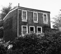 2111 Brunswick Court, Halifax, Nova Scotia, Fall 1982
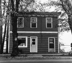 2093 Brunswick Street, Halifax, Nova Scotia, Fall 1982
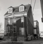 2013 Creighton Street (formerly 3 Creighton St), Halifax, 1982
 20 minutes later, I'm around the bend on Kelbaker Road, with the Providence Mountains further and further behind me
 20 minutes later, I stop for another break further out on Broadwell Dry Lake
 2.5 miles up Kelbaker Road, I make a brief stop at Black Tank Wash to remove my scarf and winter jacket
 2.5 miles beyond Nipton, I'm feeling hot again and notice some potential shade as I cross under the power lines
 15 miles on Coyote Creek Trail, then another seven miles on nasty San José streets, and I'm home!
 100 degrees F in the smoky haze
 10 minutes later, I'm almost at the next landmark, where Castle Peaks Road arrives at the slot in the rolling hills
 10 minutes later, as I approach the base of the New York Mountains, lush juniper trees like the one on the left begin to appear
 10 miles up Kelbaker Road out of Baker, I stop for a break at "the big curve," where the road turns almost 90 degrees
 10 beautiful-but-bumpy miles of riding along the train tracks from Ivanpah Rd to Nipton
 1/3 mile up the main road, I turn down the short road that dead-ends at Coyote Springs
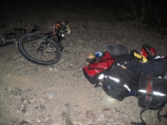 1/2 mile up the road to Old Dominion Mine, I start looking for a good campsite near another road that I also can't locate
 1.5 miles beyond Interstate 15, I reach the dirt road that will take me to Pachalka Spring and bear right
 1.5 downhill miles on the old Mail Spring Road, then 3.5 miles down Ivanpah Rd into the Lanfair Valley
 "So far, so good," I say to myself as I stop to enjoy a desert mallow and the views; I keep climbing
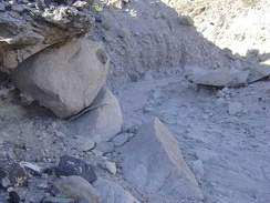 "Painted-dot" rock
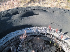 "For flat base truck rim only"
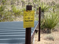 "This device for watering game birds was paid for with YOUR money"
 "The Scream"
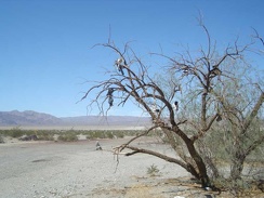 "Shoe tree" on Highway 127 across from Saratoga Springs Road