dryfj.com / drycyclist.com (kevin cook)
4758/7119
Home
/
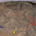
Mojave National Preserve map, Day 5: Bighorn Basin Mine day hike from Coyote Springs
Thumbnails
Previous
Next
Photo sizes
Photo sizes
✔
XXS - tiny
(244 x 193)
✔
XS - extra small
(407 x 324)
✔
S - small
(543 x 432)
✔
M - medium
(747 x 594)
✔
Original
(778 x 618)
slideshow
Albums
Mojave Preserve and Desert bikepacking trips
/
2008: Mojave National Preserve Mountain-Bike Camping and Hike
/
Day 5: Afternoon hike to an old mine site in the Bighorn Basin hills, Mojave National Preserve
Powered by
Piwigo
Join me on Facebook


)
)
)
)
)