dryfj.com / drycyclist.com (kevin cook)

6846/7119
Home /

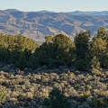
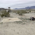
At another junction on the way to Coyote Springs, I pull out my map to look for this fork in the road

07185-bike-map-800px.jpg Morning, Humboldt-Toiyabe National ForestThumbnailsI see just one extant structure at Sands: a shed next to what looks like part of an old water towerMorning, Humboldt-Toiyabe National ForestThumbnailsI see just one extant structure at Sands: a shed next to what looks like part of an old water towerMorning, Humboldt-Toiyabe National ForestThumbnailsI see just one extant structure at Sands: a shed next to what looks like part of an old water towerMorning, Humboldt-Toiyabe National ForestThumbnailsI see just one extant structure at Sands: a shed next to what looks like part of an old water towerMorning, Humboldt-Toiyabe National ForestThumbnailsI see just one extant structure at Sands: a shed next to what looks like part of an old water tower

I don't have the USGS topography map with me, but the road to the right looks like the correct way to Coyote Springs.